
The Oceanic Engine: Upwelling and the California Current
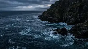 The journey of San Francisco’s fog begins hundreds of miles out in the Pacific Ocean. Running southward along the West Coast of North America is the California Current, bringing cold, subarctic water down from the Gulf of Alaska. However, the true catalyst for fog production is a physical process known as coastal upwelling.
During late spring and summer, strong northwesterly winds blow parallel to the California coastline. Due to the Earth’s rotation—a force known as the Coriolis effect—surface water is pushed offshore, perpendicular to the wind direction. As warmer surface waters drift westward, deep, nutrient-rich, and ice-cold water (often between 45°F and 50°F) is pulled up from the ocean floor to replace it near the shore.
When warm, moisture-laden air masses traveling across the broader Pacific collide with this narrow band of freezing coastal water, the air quickly cools from below. As the air temperature drops to its dew point, water vapor condenses into liquid water droplets, forming a dense stratum of advection fog hovering just above the ocean surface. You can track real-time coastal conditions and sea surface temperature updates via the NOAA National Data Buoy Center.
The Thermal Engine: How the Central Valley Pulls Fog Inland
If upwelling provides the moisture, it is California’s inland geography that acts as the pump drawing the fog ashore. During the summer months, California’s vast Central Valley bakes under intense solar radiation. Temperatures in cities like Sacramento and Fresno frequently exceed 100°F. As this landmass heats up, the air expands, rises, and creates a large zone of low atmospheric pressure over the interior of the state.
Meanwhile, the air over the cool Pacific Ocean remains dense and under high pressure. Nature always seeks equilibrium, so air naturally moves from areas of high pressure to areas of low pressure. The result is a massive, natural air conditioning system: the hot air rising in the Central Valley literally pulls the heavy, cold marine air off the ocean and drives it inland toward the continent.
San Francisco sits directly in the crosshairs of this atmospheric tug-of-war. The Coast Range mountains form a continuous vertical barrier along Northern California, blocking most of the fog from moving inland. However, there is a prominent break in this mountain wall: the Golden Gate. This sea-level gap acts as a natural funnel, compressing and accelerating the cool marine air as it rushes into the San Francisco Bay.
The Anatomy of the Marine Layer and Inversion Layers
To fully grasp San Francisco’s weather, it is essential to distinguish between simple ground fog and the broader “marine layer.” The marine layer is a stable air mass that forms over the ocean, characterized by cool, moist air trapped beneath a layer of significantly warmer air above. This boundary condition is known as a temperature inversion.
Under normal conditions, air temperature decreases as altitude increases. In a marine inversion, however, the warm air mass riding above the cool ocean layer prevents the moist air underneath from rising and dissipating. The top of this inversion layer acts like a atmospheric ceiling, compressing the fog into a band anywhere from 500 to 2,000 feet thick.
When the marine layer is shallow (under 1,000 feet), the fog struggles to cross the high peaks of the city, streaming mostly through the Golden Gate gap and low gaps in the San Mateo coastal mountains. When the marine layer deepens (exceeding 1,500 feet), it easily cascades over Twin Peaks, Mount Sutro, and Mount Davidson, blanketing the entire peninsula in a uniform shroud of gray.
For detailed historical climate data and regional microclimate mapping across California, explore resources from the Western Regional Climate Center.
Microclimates: A City Divided by Topography
San Francisco’s famously complex topography—comprising more than 40 distinct hills—interacts directly with the incoming marine layer to create dramatic neighborhood microclimates. It is entirely common for the Sunset District to hover at a chilly 55°F in dense fog, while the Mission District, just three miles east, enjoys bright sunshine and temperatures reaching 72°F at the exact same hour.
Neighborhoods along the western edge, such as the Richmond and Sunset districts, face the open Pacific and receive the full force of the incoming fog. As the moisture-laden winds travel eastward, they encounter central topographic ridges like Twin Peaks. These hills block and deflect the lower layers of fog, creating a wind-shadow effect on the eastern side of the city. Neighborhoods like the Mission, Potrero Hill, and SoMa remain shielded from the lowest fog clouds, absorbing far more direct sunlight throughout the summer.
This geographic dynamic explains why San Francisco experiences its warmest weather not in July or August, but in September and October. As summer ends, the inland Central Valley begins to cool, weakening the low-pressure draw. Without the strong thermal pressure gradient pulling cold marine air through the Golden Gate, the coastal winds subside, allowing clear skies and warm air to settle over the city during its famous “Indian Summer.” To research original meteorology field studies on Bay Area weather patterns, consult archives at the Library of Congress.
Ecological Significance: The Lifeblood of the Coastal Ecosystem

Far from being a mere weather nuisance, the marine layer fog is vital to the ecological balance of Northern California. Coastal redwoods (Sequoia sempervirens), which grow natively along the coastal fog belt, depend on fog for up to 40% of their annual water intake. Water droplets condense on the needle-like leaves high in the canopy and drip down to the forest floor—a process known as fog drip—sustaining the trees through the dry summer months.
Additionally, the regular presence of fog reduces evapotranspiration rates across native coastal scrub ecosystems, preserving crucial soil moisture for native flora and fauna. Without the protective cooling blanket of Karl the Fog, the surrounding natural landscape would resemble a far drier, semi-arid Mediterranean environment.
Conclusion: Living with the Marine Engine
San Francisco’s fog is a masterpiece of natural engineering—a delicate balance of ocean currents, solar heating, atmospheric pressure, and mountain gaps. Far more than a simple weather pattern, it defines the rhythm of life in the Bay Area. Whether you are observing it roll over the Golden Gate or watching it dissipate under an afternoon sun, Karl the Fog stands as a living testament to the powerful, interconnected geographical forces that make San Francisco truly unique.